
Ino Tadataka — The Merchant Who Walked Japan into Shape
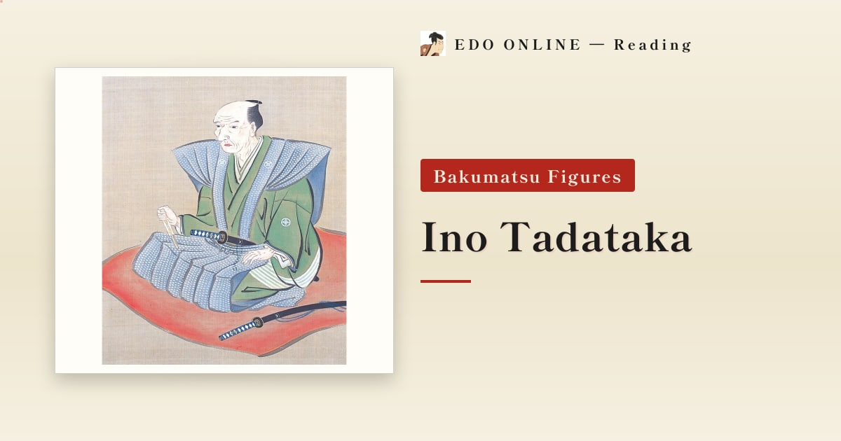
Someone once measured the shape of Japan by walking it. His name was Ino Tadataka, and he started the work at fifty-five.
Contents
Who Was Ino Tadataka?
Ino produced the first map of Japan based on systematic field measurement.
Over seventeen years he led ten survey expeditions, and the results were compiled after his death as the Dai Nihon Enkai Yochi Zenzu — the complete coastal map of Japan. Its coastlines were accurate enough that foreign visitors, comparing it against their own charts decades later, were reportedly startled by the quality.
He was born in 1745 in Kazusa Province, in what is now Chiba. He married into the Ino family of Sawara, ran their sake brewing business, expanded it substantially, and served as a village headman.
In other words, the first half of his life was a merchant's life, not a scholar's.
Why Ino Tadataka Made the Map
This is the part most often misunderstood. Ino did not set out to make a map.
What he wanted to know was the length of one degree of meridian — in effect, the size of the Earth. How far must you travel across the ground for your latitude to change by a single degree? The answer feeds directly into calendrical astronomy, and it was a live problem in his day.
To find it, you must measure a long north-south distance on the ground and observe the stars at both ends to establish the difference in latitude. That is why the work required walking very far.
When he petitioned the shogunate, the stated purpose was a map of Ezo, the northern frontier. Russian ships had begun appearing in those waters, and an accurate northern chart had obvious defensive value.
A scholarly question and a government need met at the same point, and a map of Japan came out of it.
Ino Tadataka Becomes a Student at Fifty
Ino handed the family business to his son and retired at forty-nine. He then moved to Edo and became the pupil of the astronomer Takahashi Yoshitoki.
Takahashi was thirty-one at the time — nineteen years younger than his new student. A retired merchant approaching fifty bowed to a man young enough to be his son and began again from first principles.
Takahashi is said to have found the arrangement awkward at first. But Ino's observational discipline was relentless, and he became the student his teacher relied on.
How Far Did Ino Tadataka Walk?
The first expedition set out in 1800, bound for Ezo. Ino was fifty-five. The surveys continued for seventeen years.
The method was unglamorous. Hold your stride to a fixed length, count your paces, take a compass bearing, and lay down the line. Measure with chain and rope, fix the angle, observe the stars to confirm latitude. Then do it again.
The total distance surveyed is usually given as roughly 40,000 kilometers — the circumference of the Earth. Estimates of how much of that he covered on his own feet vary between sources, but by any accounting it far exceeds what a person walks in an ordinary lifetime.
And he did all of it between the ages of fifty-five and seventy-one. Seventeen years of measuring by walking, imposed on an aging body.
Ino Tadataka Never Saw the Map Finished
Ino died in Edo in 1818, at seventy-three. The map was not done.
His students carried the work through and presented the completed Dai Nihon Enkai Yochi Zenzu to the shogunate in 1821. Until then, his death was kept quiet — the mourning withheld so that the finished map could be delivered under his name.
The respect he had shown a younger teacher came back to him from his own students, in the same shape.
Ino Tadataka's Grave
Ino is buried at Genkuji temple in Taito Ward, Tokyo.
What matters is who lies beside him: the grave of his teacher, Takahashi Yoshitoki. Ino is said to have asked to be buried near him.
He spent eternity next to the man he had bowed to at forty-nine. His entire argument about learning — that it is never too late — is preserved in the placement of a headstone.
His preserved house and a memorial museum stand in Sawara, Katori City, Chiba.
Ino Tadataka Timeline
| Year | Event |
|---|---|
| 1745 | Born in Kazusa Province (now Chiba) |
| 1762 | Marries into the Ino family of Sawara and takes over the business |
| 1794 | Retires, handing the household to his son |
| 1795 | Moves to Edo and studies under Takahashi Yoshitoki, nineteen years his junior |
| 1800 | Sets out on the first survey, to Ezo, aged 55 |
| 1800–1816 | Ten survey expeditions across Japan |
| 1818 | Dies in Edo, aged 73, with the map unfinished |
| 1821 | His students complete the Dai Nihon Enkai Yochi Zenzu |
For others who pursued Western learning in the same era, see rangaku and the Tekijuku.
Related reading
Abe Juro — The Former Member Who Talked
He deserted the Shinsengumi and rejoined under another name, shot at Kondo Isami as one of the Goryō Eji, and then grew apples in Sapporo. His late-Meiji testimony is where the ranking of the corps' best swordsmen comes from.
Ando Hayataro — The Shinsengumi's Record-Breaking Archer
He set the standing national record in the long-range shooting at the Tōdai-ji Great Buddha Hall, sending 8,685 arrows the length of the corridor. Nearly fifty, he joined the Shinsengumi and died of wounds taken in the back garden of the Ikedaya.
Hattori Takeo — Two Swords at Aburanokoji
A two-sword master and fencing instructor of the Shinsengumi who defected with the Goryō Eji. At Aburanokōji he alone wore mail, held a wall against the whole corps, and fell with more than twenty wounds.